Clonlost, Killucan, Mullingar, Co. Westmeath, N91 KX77
Quiet street: 2 applications within 500 m this year (typical outside Dublin: 4 a year).
What's planned, stalled or derelict around it, and what to ask.
Listed on daft.ie · Listed by Egans · last seen 22 Nov 2026
Planning around this home
| Description | Details | |||||||
|---|---|---|---|---|---|---|---|---|
| Awaiting decision | 24 Aug 2026 | 2661061 MEATH | Harlockstown , Dunboyne , Co Meath | the development will consist of refurbishment works to 36.3 kilometres (km) of OHL, compr… | — | — | 67 m | |
| Awaiting decision | 24 Aug 2026 | 2660445 WESTMEATH | Located along the Blundelstown – Mullingar 110 kilovolt (kV) overhead line (OHL) , commencing within Blundelstown in the townland of Harlockstown Co. Meath , and extending to the existing Mullingar 110kV substation in the townland of Irishtown Cou | development which will consist of refurbishment works to 24.2 kilometres (km) of OHL; comp… | — | — | 67 m |
Full planning report
The full planning report for Clonlost
Everything planned, built and refused around it, in one report you keep. Read it before you buy, build or object.
- 6 applications
- 3 granted
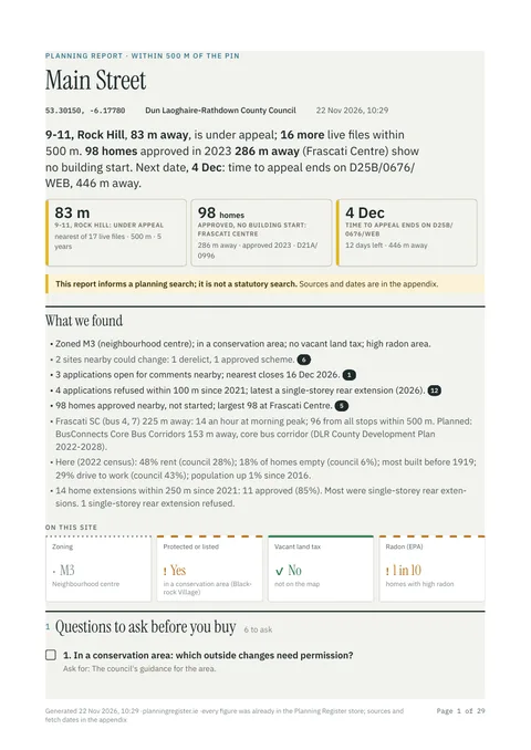
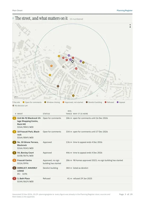
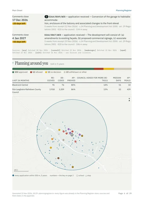
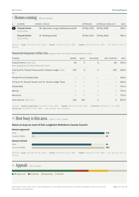
4 of about 30 pages, from a sample report in Blackrock.
Your report includes:
- Every application within 500 m: granted, refused and appealed, on a map
- What neighbours were allowed to build, and what was refused
- Deadlines to object, and sites nearby that could change
- New homes and developments coming, and building work started
- Zoning, conservation areas, protected structures and flood risk
- Questions to ask your solicitor or surveyor
one report · VAT included
Or unlimited reports for a monthly priceSecure checkout by Stripe · Opens straight after payment · PDF emailed to you
Not a statutory planning search.
About this home
Within 500 m of Clonlost, Killucan, Mullingar, Co. Westmeath, N91 KX77, Planning Register tracks 6 planning applications: 2 awaiting a decision, 3 granted, 1 refused. The home is a site in Clonlost, Westmeath of about 12141 m². It is advertised for sale on daft.ie (last seen live on 22 Nov 2026).
More about this address
The site is on the council's Record of Protected Structures. The building is recorded by the National Inventory of Architectural Heritage (reg. 15402008).
- Type
- Site
- Floor area
- 12,141 m²
- Eircode
- N91 KX77
- Local authority
- Westmeath County Council
- Protected structure
- On the Record of Protected Structures
- NIAH
- Recorded, reg. 15402008 · Regional rating