Planning report · Cork County Council · 500 m around this site · the last 12 months · 22 Nov 2026, 15:32
Aglish ED, Municipal District of Macroom, County Cork, Munster, Éire / Ireland
51.88198, -8.72670
Homes here mostly date from the 1970s.
See what’s in the full report →
Full planning report
The full planning report for Aglish ED
Everything planned, built and refused around it, in one report you keep. Read it before you buy, build or object.
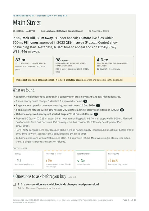
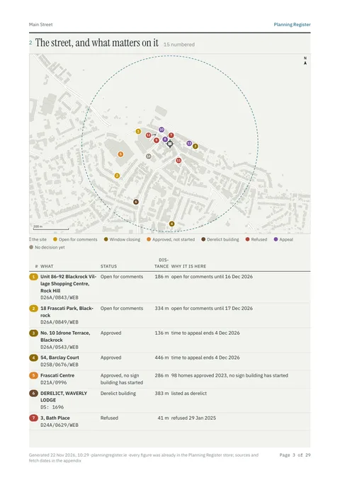
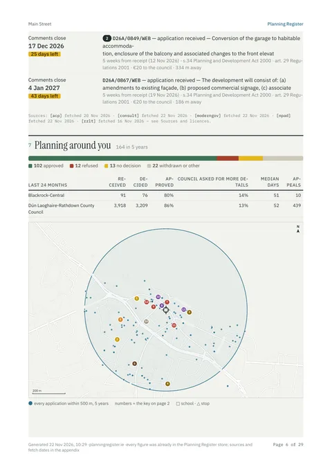
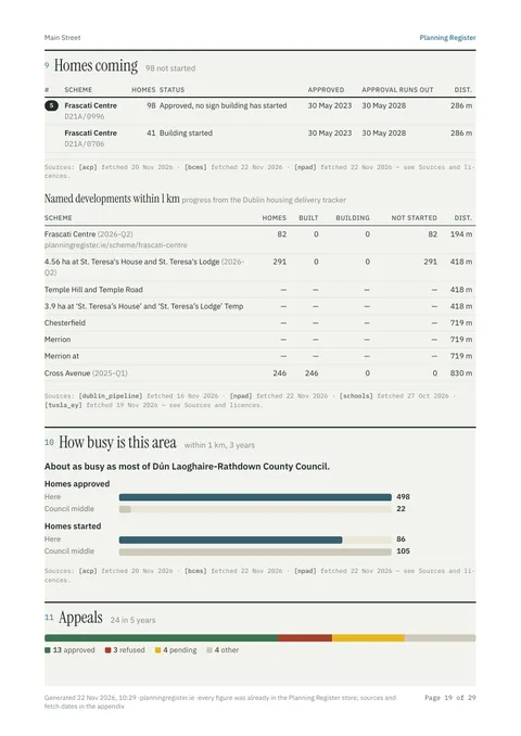
4 of about 30 pages, from a sample report in Blackrock.
Your report includes:
- Every application within 500 m: granted, refused and appealed, on a map
- What neighbours were allowed to build, and what was refused
- Deadlines to object, and sites nearby that could change
- New homes and developments coming, and building work started
- Zoning, conservation areas, protected structures and flood risk
- Questions to ask your solicitor or surveyor
one report · VAT included
Or unlimited reports for a monthly priceSecure checkout by Stripe · Opens straight after payment · PDF emailed to you
Not a statutory planning search.
Where this is, the terms, the sources
Not held yet for Cork County Council: council consultations.
- Townland
- Ballineadig
- Electoral division
- Aglish
- Electoral area
- Macroom
- Council
- Cork County Council
Everything we found, as a list 4 lines
- No vacant land tax.
- Here (2022 census): 88% owner-occupied (council 73%); 8% of homes empty (council 13%); most built 1971–1980; 66% drive to work (council 66%); population up 5% since 2016.
- The council decides in a median 67 days (about 10 weeks).
- 7 homes started within 1 km in 3 years (council middle 1).
What the terms mean 3 terms
- Vacant land tax (Residential Zoned Land Tax (RZLT)): A yearly tax of 3% of the land's value on land that is zoned for homes and serviced but left unbuilt.
- Approved (Grant of permission): The council said yes, usually with conditions.
- What the land is zoned for (Zoning objective): The council's development plan sets what each area is for: homes, shops, open space and so on.
Sources and licences 25
| Source | Publisher | Licence | Fetched |
|---|---|---|---|
| EPA strategic noise maps | CC BY 4.0 | ||
| Fingal County Council | CC BY 4.0 | ||
| Fingal County Council and Dún Laoghaire-Rathdown County Council development plan layers (CC BY 4.0) | CC BY 4.0 | ||
| National Transport Authority | CC BY 4.0 | ||
| services-eu1.arcgis.com | An Coimisiún Pleanála | CC BY 4.0 | 20 Nov 2026 |
| data.nbco.gov.ie | National Building Control Office (BCMS) | CC BY 4.0 | 22 Nov 2026 |
| data.gov.ie | Various (see each layer) | CC BY 4.0, CC BY-NC-ND 4.0 | 27 Sept 2026 |
| services-eu1.arcgis.com | National Monuments Service (SMR) | CC BY 4.0 | 27 Sept 2026 |
| dlrcoco.citizenspace.com | Local authorities (consultation portals) | Public | 22 Nov 2026 |
| www2.courts.ie | © the publisher | 21 Nov 2026 | |
| cso.ie | CC BY 4.0 | ||
| dartplus.ie project extents over NTA GTFS rail shapes (CC BY 4.0) | CC BY 4.0 | ||
| services-eu1.arcgis.com | Local authorities (derelict sites registers) | CC BY 4.0 | 16 Nov 2026 |
| data.epa.ie | Environmental Protection Agency (LEAP licence register) | CC BY 4.0 | 17 Nov 2026 |
| transportforireland.ie | National Transport Authority | CC BY 4.0 | 15 Nov 2026 |
| lda.ie | Land Development Agency | CC BY 4.0 | 11 Sept 2026 |
| meetings.fingal.ie | Local authorities (council meetings) | Public | 22 Nov 2026 |
| services.arcgis.com | Department of Housing (National Planning Application Database) | CC BY 4.0 | 22 Nov 2026 |
| services-eu1.arcgis.com | Tailte Éireann | CC BY 4.0 | 11 Sept 2026 |
| services-eu1.arcgis.com | CSO, Tailte Éireann, OpenStreetMap contributors | CC BY 4.0 | 4 Oct 2026 |
| propertypriceregister.ie | Property Services Regulatory Authority (PPR) | © PSRA, PSI licence | 22 Nov 2026 |
| services.arcgis.com | Local authorities (RZLT maps) | CC BY 4.0 | 16 Nov 2026 |
| gov.ie | Department of Education | CC BY 4.0 | 27 Oct 2026 |
| gov.ie | Department of Housing | CC BY-SA 4.0 | 20 Nov 2026 |
| services.arcgis.com | Local authorities via the Department of Housing (GZT / MyPlan) | CC BY 4.0 | 15 Nov 2026 |
How we work this out
Generated 22 Nov 2026, 15:32 from the Planning Register store; nothing was fetched live. Not a legal search: the council's planning file is the record. Deadlines come from published dates under the Planning and Development Act 2000: confirm with the council before relying on them. Counts are from public registers; rates and medians are worked out from those counts; the kind of work is read from each application's description; build years are census estimates. Street map © OpenStreetMap contributors; building outlines © Overture Maps Foundation.